

Sliabh Chathair na Gaoithe [Cahernageeha Mountain]
Good walks are even better shared.
Overview
Sliabh Chathair na Gaoithe (Cahernageeha Mountain)
Overview
Sliabh Chathair na Gaoithe, affectionately known as Cahernageeha Mountain, rises to 705 meters and is a prominent feature of the beautiful Galtee Mountains in Ireland. The peak offers an adventurous hike with stunning views and a dash of geological wonder.
Geology
The mountain is primarily composed of granite and schist, remnants of ancient geological activity. Understanding the formation of these rocks gives insight into the broader glacial history of the area — you might even imagine these stones gossiping about the ice ages!
Routes
Cahernageeha Loop
- Distance: 9.5 km
- Time: Approximately 3.5 hours
- Difficulty: Moderate
This route begins in the picturesque Glen of Aherlow, winds through serene valleys, and climbs towards the summit. The changing terrain keeps hikers engaged, with rocky paths and enchanting views around every corner.
Summit Features
Upon reaching the summit, hikers are greeted by a humble stone cairn, standing sentinel over the breathtaking vistas. It's the perfect spot for a selfie — just don't forget to make your friends jealous!
Terrain
Expect a delightful mix of rocky outcrops and grassy patches, interspersed with a few boggy sections that might have you feeling like you're on a nature-themed obstacle course. Sturdy footwear is highly recommended!
Views
From the summit, enjoy sweeping panoramic views that include ephemeral glimpses of the Galtee Mountains, the winding River Aherlow, and on clear days, the iconic Slieve Mish Mountains in the distance. Spring and autumn are particularly magical times, as the landscape explodes with colour.
Hazards
Though the mountain invites all nature lovers, it’s worth noting some potential hazards. Loose rocks and slippery paths can be a challenge, particularly when wet. Keep an eye on the weather, as mist can descend rapidly, turning the adventure into a treasure hunt for the path!
Access
- Nearest Parking: Available at the Glen of Aherlow trailhead, accommodating around 15 vehicles.
- Public Transport: Limited options; best to come by car.
- Nearest Town: Bansha is the nearest village, about 9 km from the parking area, boasting a small shop and café for those necessary post-hike treats!
Facilities
While not too far from urban comforts, facilities are limited around the trail. Bansha offers a delightful respite after your trek, including a shop and public toilets.
History
The name Cahernageeha translates to 'the stone ring fort of the wilds', a nod to the rich tapestry of history embedded in this location. Hikers may find themselves walking in the footsteps of ancient inhabitants, their tales still whispered on the winds.
In conclusion, Sliabh Chathair na Gaoithe is a hidden gem for lovers of the great outdoors. Whether you're seeking stunning views, intriguing geology, or a memorable day on the hill, this mountain is sure to deliver. Happy hiking!
Explore routes near Sliabh Chathair na Gaoithe [Cahernageeha Mountain]
Public walks starting within 80 km of this hill. Nearby does not mean a route reaches the summit; check its map and access before setting out.
No public routes are currently listed within 80 km of Sliabh Chathair na Gaoithe [Cahernageeha Mountain] on Walkmates. This does not mean there are no paths here. Explore the map and check local access information before planning a walk.
Route planning notes
These notes describe possible approaches, not verified navigable routes or permission to cross land. Check current paths, local access rules and conditions before setting out.
Cahernageeha Loop
A scenic route starting from the Glen of Aherlow, this loop takes you through lush valleys and rocky outcrops, eventually leading to the summit.
Make a day of it, together
Find someone to share the walk with, or organise a day out along a route you like.
Photo Gallery
View all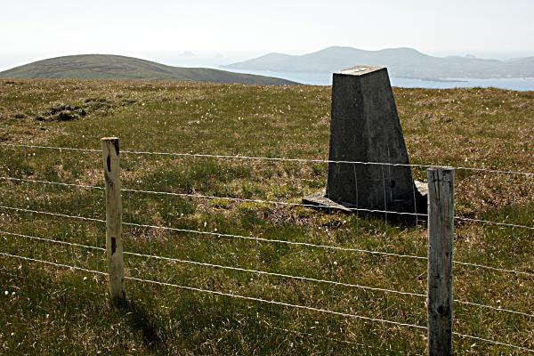 Photo could not load
V5361 : Trig Pillar
kevin higgins
Hill facts and local notes
Classifications
Elevation
499m
1,636 ft
Prominence
121m
Coordinates
51.7861, -10.1171
V539613
OS Map
83 84
At the Summit
The summit features a stone cairn marking the highest point, with a wonderful 360-degree view showcasing both the Galtee Mountains and the surrounding valleys.
Terrain & Geology
The mountain primarily features granite and schist, offering a unique perspective on glacial history and erosion processes that have shaped the landscape over millennia.
Views & Scenery
Panoramic views of the Galtee Mountains, the River Aherlow, and on a clear day, the distant Slieve Mish Mountains.
History & Heritage
Name Origin
The name 'Cahernageeha' translates to 'the stone ring fort of the wilds', which hints at the historical significance of the area.
Historical Significance
This mountain has long been a site of natural beauty and local folklore, often associated with tales of ancient settlements.
Getting There & Facilities
Check current local access restrictions, parking rules and transport timetables before travelling. These notes do not confirm public access to the summit.
Parking
There is a car park at the base of the Cahernageeha Loop trail, located off the R663 road, accommodating around 15 vehicles.
Public Transport
Public transport options are limited; the nearest bus route is in Tipperary town (approximately 25 km away), so a car is advisable.
Nearby Facilities
Facilities in Bansha include a small shop and a café, as well as public toilets.
Safety Information
Known Hazards
- Watch out for loose rocks and slippery paths, especially in wet conditions. Mist can come down quickly, reducing visibility.
General Safety Tips
- Check weather conditions before setting out
- Carry appropriate clothing and equipment
- Let someone know your planned route
- Take a map, compass, and GPS device
- Carry emergency supplies: food, water, first aid kit, torch
Hills
Some common questions about the hills answered
Are there group walks up Sliabh Chathair na Gaoithe [Cahernageeha Mountain]?
Many walkers use Walkmates to join or organise walks with others. You can check for group walks around Sliabh Chathair na Gaoithe [Cahernageeha Mountain] through the maps
Are there other walkers around Sliabh Chathair na Gaoithe [Cahernageeha Mountain]?
Activity varies by location and time, but Walkmates lets you see whether others have shared walks or shown interest in this area. Find other people through the walking friends search walking friends for Sliabh Chathair na Gaoithe [Cahernageeha Mountain] search or of course create your own walk for Sliabh Chathair na Gaoithe [Cahernageeha Mountain]
Can I organise a walk to Sliabh Chathair na Gaoithe [Cahernageeha Mountain]?
Yes. If there aren’t any walks listed already, you can create a walk and make it available for others to join.
If you're signed up to Walkmates, you can create a walk to Sliabh Chathair na Gaoithe [Cahernageeha Mountain].
How do I find a walk up this hill?
There are often multiple ways to walk this hill, depending on experience and route preference. Walkmates helps you explore walks and routes that others have shared.
Can I suggest a new route up Sliabh Chathair na Gaoithe [Cahernageeha Mountain]?
Yes. You can suggest or create routes to share with others. Walkmates focuses on the social side of walking, so routes are used to help people organise walks and explore areas together, rather than as detailed navigation tools or route libraries.
Other uses really appreciate knowledgeable walkers sharing their routes. Share your favourite route to Sliabh Chathair na Gaoithe [Cahernageeha Mountain] here
The is an error or something incorrect about this hill. How do I let you know?
We always strive to keep the information on Walkmates as accurate as possible. If you find an error, please let us know through the contact form and we'll aim to correct it as quickly as possible
Community Discussion
Comments
Location
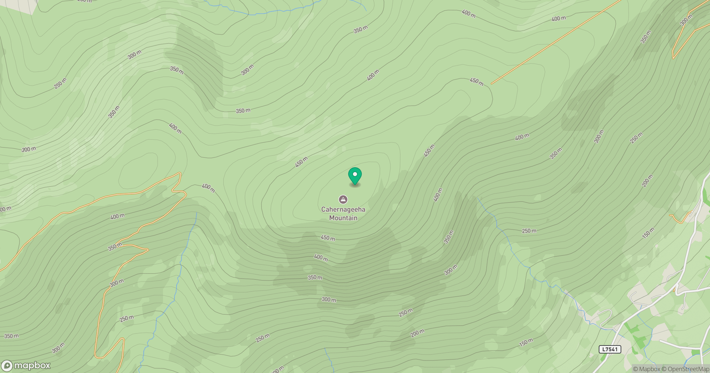
Grid reference: V539613
View on OpenStreetMapOpens a map in a new tab, centred on the hill.
Hills within 30 km
Straight-line distance, not a walking route or confirmation of access.
Sceilg Mhichil [Great Skellig]
217m
An Rath [Eagle Hill]
155m
Binn Ui Ruairc [Beenarourke]
304m
Eagles Hill [An Bhinn Riabhach]
549m
An Bheann Mhor
675m
No comments yet. Be the first.